
Humans Were Water is an interactive water installation blending physical and digital water.
It questions how the world’s digitalization reshapes Humans connection to the essence of things.
It is a journey between cognition and sensation, a journey between knowing and feeling.
Description
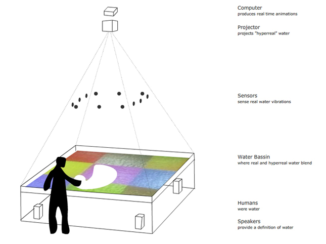
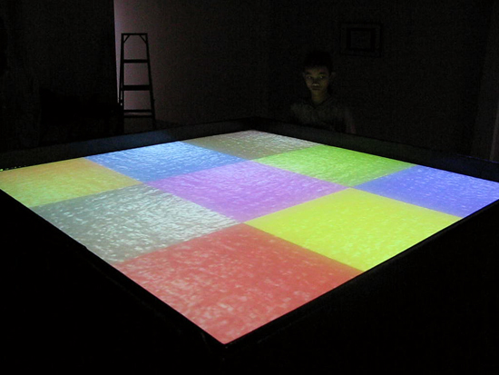
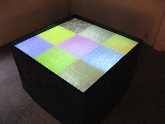
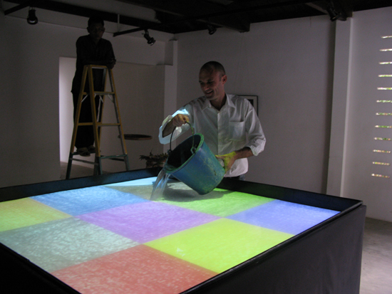
Aerial video footage of water locations, recolored according to Google Maps color codes, are projected onto a 1.5 x 1.5m basin filled with real water. A text-to-speech reader gives the Wikipedia definition of water.
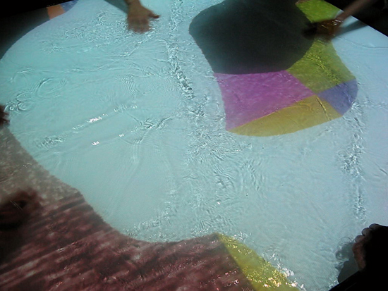
The audience stands above, excluded from the water. However, one can easily immerse hands in the liquid.
The installation is equipped with sensors that detect ripples created by visitors’ interactions. When ripples are generated, the digital layer of artifical water is removed, thus, revealing the real water. Simultaneously, the text-to-speech reading gets quieter and the real sound of water can be heard.
Thus, visitors are translated from the cognitive to the sensory layer.
Humans come from the water, micro-organism produced in the water, then warms, fishes, tetrapods, a long line of bipeds all the way to us, homo-sapiens. What remains of our ties with the nature when we connect the world with technological interfaces? Are these becoming more real than real itself? What happens when we stand here, at the border, the frontier between the real and its representation?
Sketch
Readings
On Exactitude in Science – Jorge Luis Borges
“In that empire, the art of cartography attained such perfection that the map of a single province occupied the entirety of a city, and the map of the empire, the entirety of a province. In time, those unconscionable maps no longer satisfied, and the cartographers guilds struck a map of the empire whose size was that of the empire, and which coincided point for point with it. The following generations, who were not so fond of the study of cartography as their forebears had been, saw that that vast map was useless, and not without some pitilessness was it, that they delivered it up to the inclemencies of sun and winters. In the deserts of the west, still today, there are tattered ruins of that map, inhabited by animals and beggars; in all the land there is no other relic of the disciplines of geography.”
Simulacra and Simulation – Jean Baudrillard on Jorge Luis Borges’ fable
“The territory no longer precedes the map, nor survives it. Henceforth, it is the map that precedes the territory – precession of simulacra – it is the map that engenders the territory and if we were to revive the fable today, it would be the territory whose shreds are slowly rotting across the map. It is the real, and not the map, whose vestiges subsist here and there, in the deserts which are no longer those of the Empire, but our own. The desert of the real itself.”
Photos
Tech
The aerial videos were produced using a wireless camera fixed to helium balloons. The interaction is done through interface-z IR sensors. The software that runs the all installation (interaction & animations) is MaxMSP/Jitter.
Exhibitions
The project was exhibited at Centre culturel français (CCF) of Siem Reap Cambodia.
Team
The project was created and developed by Philippe Chollet. Thank you to Centre culturel français du Cambodge for the support. Thank you for their help to Ronan Durand, Sophal Hak, Samuel Bartolin, Chris Lane, Gauthaman Ravindran and Pascale Hancart Petitet.